Form of Government
Archuleta County is a statutory County located in southwest Colorado that was created on April 14, 1885. It is one of 64 counties created by the State of Colorado. Archuleta County is governed by three County Commissioners. Commissioners are elected at-large from three geographic districts and must reside in the district for which he or she is elected; County Commissioners serve four-year terms. In addition to the County Commissioners, there are also six other elected officials – Assessor, Clerk and Recorder, Coroner, Sheriff, Surveyor and Treasurer. The County Treasurer is also the Public Trustee. Pagosa Springs is the county seat in Archuleta County and is the only incorporated municipality in the County.

Geography
Archuleta County is located in the Southwest region of Colorado and is bordered by La Plata County on the west, Hinsdale and Mineral Counties on the north, Rio Grande County on the northeast, Conejos County on the east and the state of New Mexico on the south.
Archuleta County covers 1,355 square miles, of which 31% is private lands, 49% is San Juan National Forest and 14% is Southern Ute Tribal Lands.
Climate

Archuleta County’s summers are fairly mild with the average high in July being only 83°. Archuleta County receives an average of 116 inches of snow annually and with Wolf Creek Pass only a short drive from downtown Pagosa Springs, Archuleta County is a great destination for winter sports. Combining snowy winters and mild summers Archuleta County is an optimal location for outdoor enthusiasts.
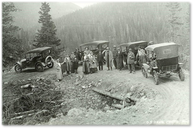
Archuleta County History
The Anasazi (Ancestral Puebloan) people were the earliest known inhabitants of Archuleta County and the surrounding area. Archaeological evidence at the Chimney Rock Indian ruins indicates a thriving community in and around the site until about 1125 AD. Following the Anasazi were the Navajo, Ute, and Jicarilla Apache peoples who have lived and hunted in the area for centuries. Revered by the Native Americans, the Pagosa (a Ute word meaning ‘healing’ or ‘boiling water’) hot springs were frequented by many of the tribes. In 1848, Mexico ceded the area to the United States. The U.S. Government then established relations with the Native Americans and through a series of Treaties “bought” most of their land. In the Brunot Treaty of 1873, the Southern Ute Reservation was established in its present location.
In 1859, the U.S. Army sent out an expedition through the Archuleta County area headed by Captain John Macomb, and soon after in 1860 gold was discovered in the San Juan Mountains. For the next 30 years, prospectors and settlers poured into the area. In 1878, Fort Lewis was established along the San Juan River next to the great Pagosa hot springs to protect settlers and travelers from the Native Americans. With Calvary Troops, Cowboys and Native Americans, gunfights and stagecoach holdups, Archuleta County was the embodiment of the Wild West.
Hispanic settlers reached the area about the same time as Anglo settlers. They settled the southern part of the County along the rivers. Hispanic communities such as Trujillo, Juanita, Pagosa Junction, and Carracas were settled with the arrival of the Denver & Rio Grande Railroad in 1881.

Archuleta County was created by the Colorado legislature on April 14, 1885, out of western Conejos County. It was named for J. M. Archuleta, “head of one of the old Spanish families of New Mexico”, and in honor of Antonio D. Archuleta, who was the Senator from Conejos County at the time. The Town of Pagosa Springs, which grew around Fort Lewis and remained after the fort moved west, was platted and surveyed in 1883 and incorporated in 1891. It remains the only incorporated town in the County.
The growth of cattle and sheep ranching, as well as the development of the lumber industry, led to a booming economy in the 1890’s and helped to bring the railroad to Pagosa Springs in 1900. With the advent of the railroad running between Silverton, Durango, Chama and points east along the southern boundary of the County, the lumber industry flourished and became the dominant sector of the economy. The railroad also boosted ranching by providing a practical way to ship cattle and sheep to market.
On August 21, 1916 a new highway built by the State of Colorado over Wolf Creek Pass was opened. Along with the new modern highway, came electricity and the telephone. The Old West was gone. The lumber boom lasted almost into the 1920’s, by which time the easily accessible timber had all been logged. Following shortly after was the Great Depression and World War II. Many of the rural residents of the County were forced to move either into town or further away out of the County to work in defense manufacturing plants.
In the 1970’s, the Pagosa Springs area and Archuleta County, became a beacon for land developers. With all the beautiful scenic panoramas of mountains, forests and streams, buyers with extra money to spend came from all around the Country and helped grow Archuleta County into the unique experience you have today.